Citizen engagement is critical to keeping our State’s waters clean and protected. With (over) 10,000 lakes and thousands of miles of streams and rivers, ensuring that we are abiding by the Clean Water Act in this state is a daunting task, and one that can not be left to government alone. In addition to collaborating with PCA staff on collecting critical technical information about State waters, our office is also taking the lead on trying to engage citizens to become aware of the stressors impacting the lakes, rivers and streams that run through their property. With over half of our district’s lands in private hands, good stewardship is critical to not only protecting waters that are clean but also implementing projects to restore polluted waters as quickly as possible.
In June 2014, our office led 11 community information meetings within the St. Louis River watershed and the Lake Superior South watershed. We had attendance of between two and 25 people at each meeting. Major topics were the new MPCA Watershed Approach and the results of intensive monitoring in these watersheds. Upcoming meetings are being planned for this coming spring from Duluth up to Virginia in cooperation with the North St. Louis Soil & Water Conservation District. These gatherings will be focused on the results of the Stressor Identification Report for the St. Louis River Watershed. The Stressor Identification document is the second formal document that comes out of the Watershed Restoration and Protection Process (WRAPS) and uses field data and research to try to identify what is causing a stream to be impaired. For example, too much turbidity in a stream (the impairment) might be caused by a stressor such as an unstable channel that is cutting into its banks. During high flows the stream will wash away dirt from these eroded banks, causing the water to become muddy when it should be clear.
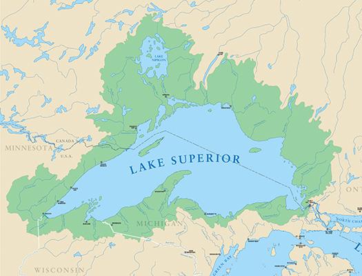
The Lake Superior Basin
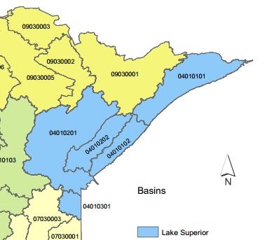
The blue area of the map below shows the Lake Superior Basin within Minnesota, sub-divided into 5 ‘major watersheds’. We are currently working with two of them.
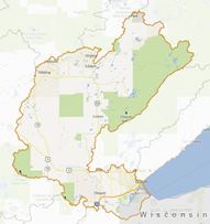
The St. Louis River watershed begins on the Iron Range. (The Cloquet River is considered a separate watershed). Click on the map below to visit PCA’s interactive webpages detailing the St. Louis River major watershed.
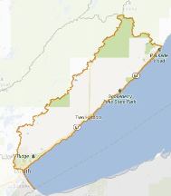
Lake Superior South watershed is comprised of all the creeks and rivers flowing directly into Lake Superior between downtown Duluth and Silver Bay. Click on the map below to visit PCA’s interactive webpages detailing the Lake Superior South major watershed.